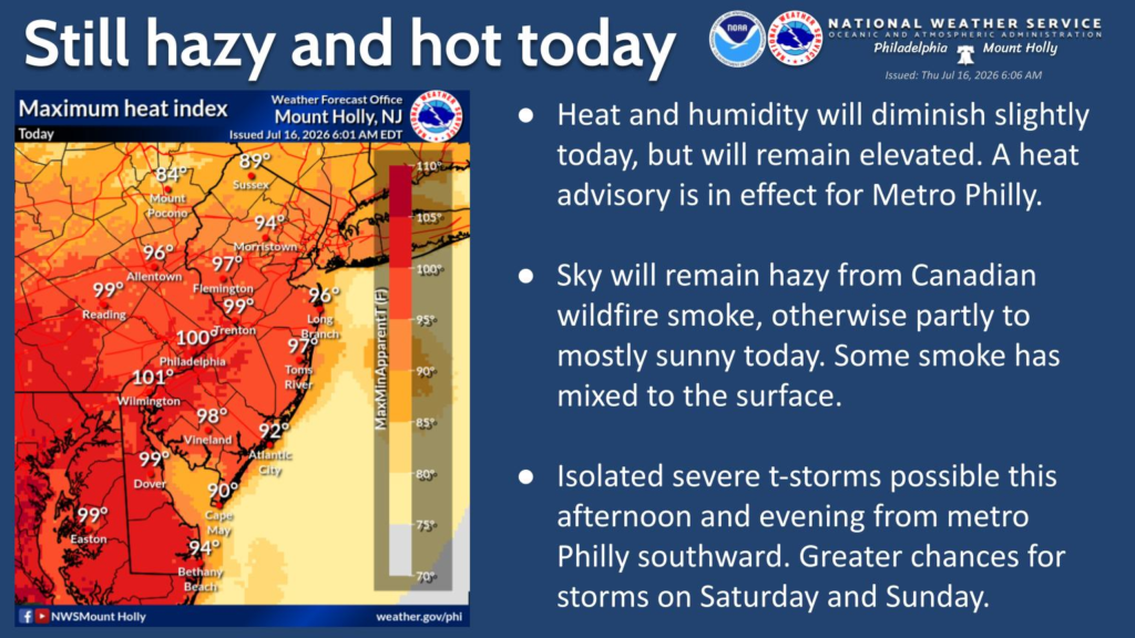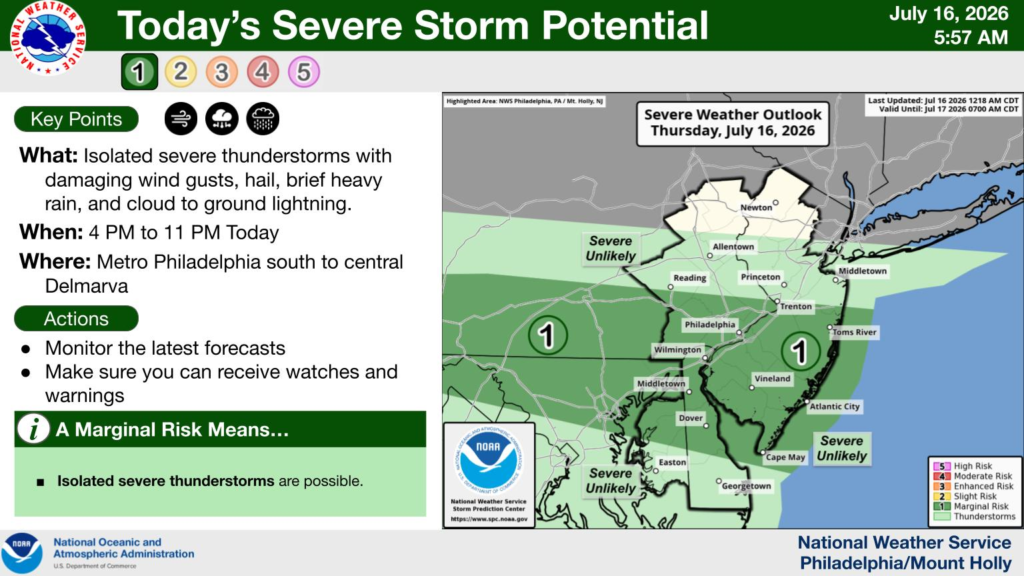


Heat and humidity will decrease slightly for today, but will still approach danger levels, especially in the urban core. A heat advisory has been issued for metro Philadelphia for today. There is a risk of isolated severe thunderstorms (20% chance) near and south of Philadelphia after 4 PM this afternoon and evening. Areas of near surface smoke from Canadian wildfires will remain and may thicken by tonight.
What has changed:
- There is now a Marginal Risk (level 1 out of 5) for severe thunderstorms across the area from metro Philly south to central Delmarva.
- A Heat Advisory is in effect for Philly metro today.
Hazardous Weather: Elevated heat and humidity. Maximum heat indices 95-105° area wide. High temperatures in the mid-upper 90s° in most areas. Isolated severe thunderstorms possible, with damaging winds being the main threat.
Timing: The hottest conditions will occur this afternoon, though not quite as hot as yesterday. Timing of any thunderstorms will be between 4 PM and 11 PM.
Locations Affected: For the dangerous heat: Metro Philadelphia. For the isolated severe thunderstorm risk: Philly metro southward to central Delmarva.
Impacts: Prolonged periods outside without frequent breaks and hydration could result in heat related illnesses. Damaging wind gusts could cause tree damage, resulting in power outages and road closures.
Experimental NWS HeatRisk website designed to forecast heat related impacts. The region is within the Major (3 out of 4) category today.
For the latest forecast please visit www.weather.gov/phi.
If you have any questions, please contact our office. This will be the only briefing for today’s heat and severe storms risks, unless there are any significant changes to the forecast.
Sincerely,
NWS Mount Holly